File:Tarassian Union Population Map.png
Jump to navigation
Jump to search

Size of this preview: 470 × 599 pixels. Other resolutions: 188 × 240 pixels | 377 × 480 pixels | 603 × 768 pixels | 804 × 1,024 pixels | 1,419 × 1,808 pixels.
Original file (1,419 × 1,808 pixels, file size: 149 KB, MIME type: image/png)
Summary
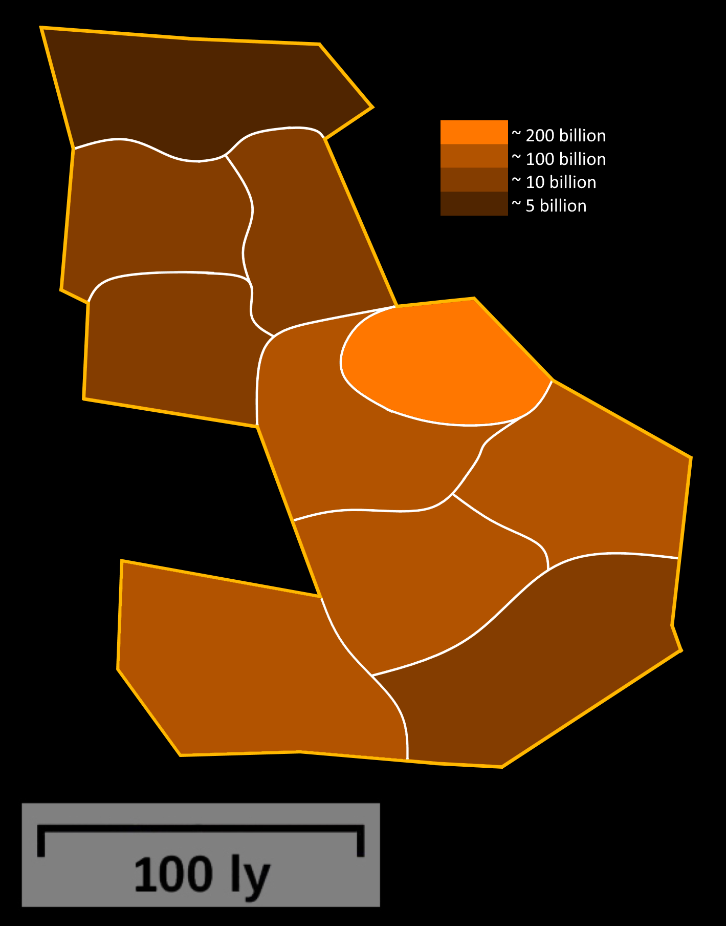
Map with the Tarassian Union's population according to each sector
File history
Click on a date/time to view the file as it appeared at that time.
| Date/Time | Thumbnail | Dimensions | User | Comment | |
|---|---|---|---|---|---|
| current | 20:33, 11 June 2021 | | 1,419 × 1,808 (149 KB) | StoicMetoik (talk | contribs) | |
| 01:05, 27 March 2021 | 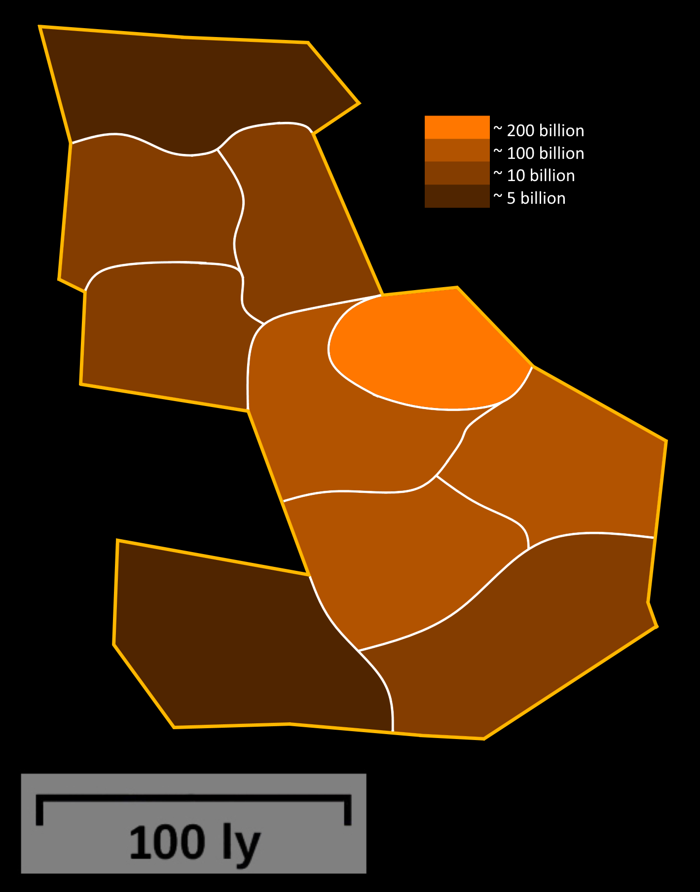 | 1,419 × 1,808 (152 KB) | StoicMetoik (talk | contribs) | Map with the Tarassian Union's population according to each sector |
You cannot overwrite this file.
File usage
The following page uses this file: