Difference between revisions of "Earamia (Pacifica)"
Jump to navigation
Jump to search
>Canadian Maps (Eareamland) |
>Canadian Maps (Eareamland) |
||
| Line 9: | Line 9: | ||
|symbol_type = National/Government CoA | |symbol_type = National/Government CoA | ||
|national_anthem = Proud Eareamland | |national_anthem = Proud Eareamland | ||
|image_map = [[File:Closeup_%2B_stuff.png|framed| | |image_map = [[File:Closeup_%2B_stuff.png|framed|100px]] | ||
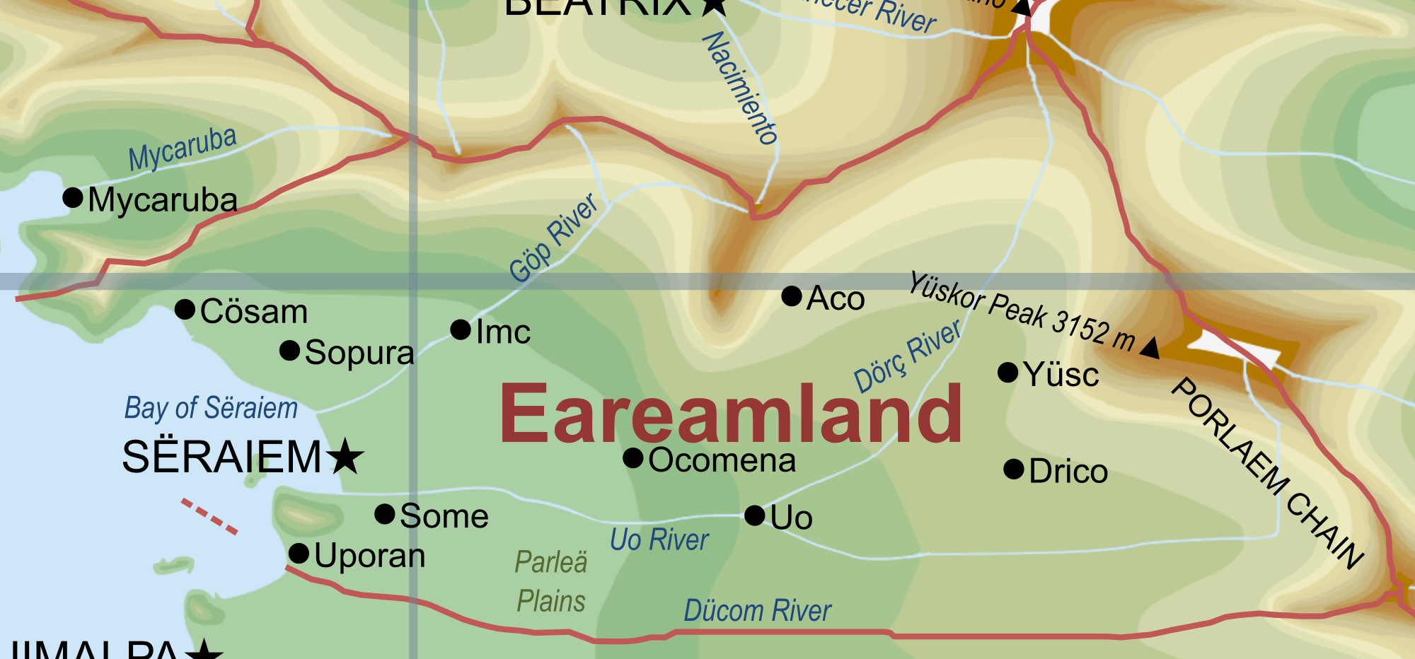
|map_caption = Closeup map of Eareamland, not all cities. | |map_caption = Closeup map of Eareamland, not all cities. | ||
|capital = Sëraiem | |capital = Sëraiem | ||
Revision as of 19:13, 17 October 2020
The Kingdom and Lands belonging to the People and King of Eareamland Ëremlant | |
|---|---|
|
National/Civil/Government Flag | |
Anthem: Proud Eareamland | |
Closeup map of Eareamland, not all cities. | |
| Capital and largest city | Sëraiem |
| Official languages | Eareamian, other tribe languages |
| Recognised national languages | Eareamian, other tribe languages |
| Religion | Secular |
| Demonym(s) | Eareamian |
| Government | Parliamentary Monarchy |
• King | James I |
• Prime Minister | Pömane Lekamas |
| Area | |
• Total | 295,528 km2 (114,104 sq mi) |
| Population | |
• Estimate | 48174310 |
| GDP (nominal) | estimate |
• Total | 1830623780000 |
• Per capita | 38000 |
| Currency | Oëm (OEM) |
| Time zone | UTC+2 (UTC +2) |
| Date format | dd/mm/yyyy CE |
Eareamland officially the Kingdom of Eareamland is a nation located in the South Pacific, near the equator on the western side of Bailtem where it borders 4 other countries.
It is urbanised on its western coast, while the mountains on the east side are less populated, however have large amounts of tribes.

